
3, 2, 1… Thunderbirds are… Go!
My brother and I grew up on Thunderbirds. It aired in 1965–66, so by the time we found it in the 90s we were watching rerun after rerun.
The appeal was never really the plot. It was the stuff. The set pieces, the miniatures, an island full of architectural detail, a rescue vehicle purpose-built for every category of catastrophe. Weather effects, explosions, and puppeteers, all working together to convince us this was happening live on camera. Every episode had an evil organisation sabotaging a large enterprise operation, impending doom on a national scale, and the Tracy family launching a secret global rescue organisation out of a swimming pool.
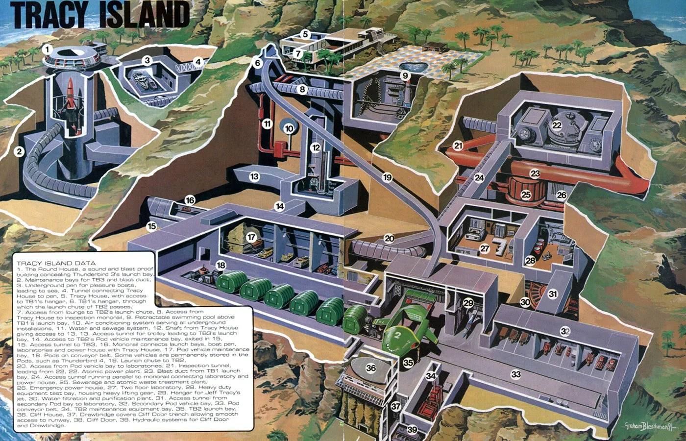
Tracy Island
They had a plan for every disaster. That was the fantasy.
https://neverwasmag.com/2019/11/the-fabulous-locations-of-thunderbirds/
Growing up watching the real version on the news: Deepwater Horizon, 9/11, the Miami airplane crash, the Nepal floods - you do wonder whether a real International Rescue could exist. Probably not in that shape. A single base of operations means you arrive on the other side of the world twelve hours after the window closed. Global rescue isn't a building. It's a distribution problem.
But the gadgets? The gadgets were real.
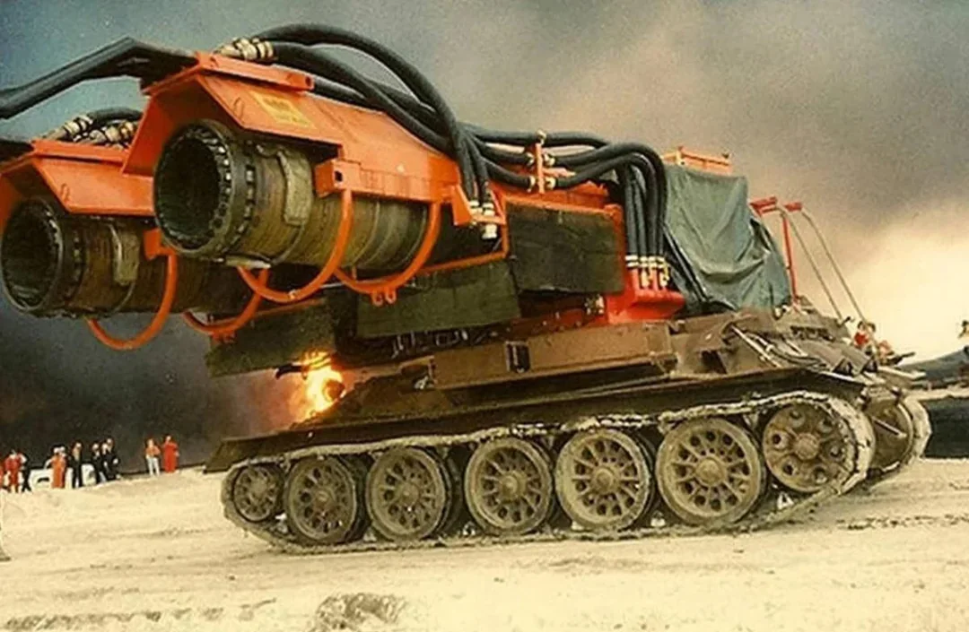
The first one I ever saw in action was in Kuwait, at the burning oil wells after the Gulf War. Big Wind: a Hungarian machine built on a T-34 tank chassis with two MiG-21 jet engines bolted on top. Six high-pressure nozzles firing about 220 gallons of water a second (roughly 800 litres) straight into the jet exhaust and out at the wellhead.
Like blowing out a candle: the exhaust displaces the gushing column of oil, starves the fire of oxygen, and cools everything around it at the same time. Three-person crew. Top speed of three miles an hour. Nine or ten wells extinguished in a 43-day deployment.
Somebody looked at a tank, a fighter jet and a fire hose and saw one machine.
That's the part that stays with me. Not the invention of something new: the repurposing of something that already existed.
My own work environment doesn't include disaster management scenarios. I'm not on a secret council, and the picture frame in my office does not hide a passage to a rescue rocket. I design retail interiors and architectural projects, and I scan buildings.
But working with Gaussian Splatting, and watching what's happening with the God's Eye View project on GitHub, I keep circling the same thought: how valuable real-time spatial data becomes the moment things go wrong - and whether anything in our toolset is any use at all in that moment.
Then I watched a recap of the rescue efforts in Nepal.
On 26 August, floods tore through Rasuwa district. Nine days later, on 4 September, two men, Sanjay Shah and Kabir Maharjan, were pulled alive out of a tunnel at the Trishuli 3A hydropower project. Nine days. Under all of that.
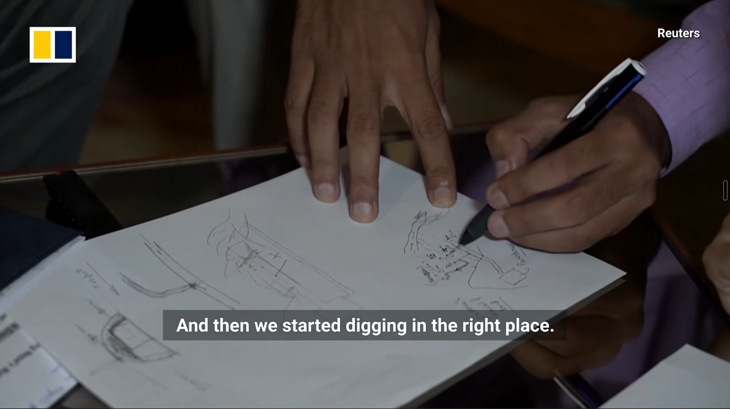
What struck me first was not the technology. It was the faith. The absolute refusal, nine days in, to accept that there was nobody left to find. Given the scale of the devastation, I couldn't quite believe people were still being pulled out.
And then a detail in the recap caught me. To reach the tunnel, the team had to dig down to it, working from a general idea of where it ran. It was mentioned that an earlier attempt had been made in a different spot before they found the right one.
I want to be careful here, because I'm a long way from that hillside and I have no rescue experience whatsoever. Those teams got two men out alive after nine days. That is the outcome, and nothing I'm about to say improves on it.
But it left me with a question I can't put down.
Somebody drew that tunnel.
A tunnel at a hydropower project is not a mystery. It was surveyed, set out, modelled, staked and built. There is an alignment, a chainage, an as-built. That information existed: in a folder, on a server, in a contractor's office, in somebody's project archive.
So, to my humble use of SketchUp, and everything sitting next to it: could you take an as-built, georeference it, and use Trimble SiteVision with a DA2 receiver to simply stand on the mountainside and look down at the tunnel beneath your feet? SiteVision Pro quotes 1 cm horizontal and 2 cm vertical with RTK. Not "somewhere in this area." A pin in the ground, with the portal drawn through the mud.
Could you then combine Trimble Siteworks with a Gaussian splat of the actual catastrophe - the terrain as it is now, after the water moved half the mountain- and see the difference between the site as designed and the site as it survived?
The obvious objection is one I raised with myself immediately: in a catastrophe of this nature, local cellular service and the towers themselves may be damaged or gone. RTK corrections usually arrive over a network. No network, no centimetres.
Except that problem has already been largely solved, and not by anyone thinking about rescue. Trimble's RTX correction services deliver over L-band satellite as well as over IP, precisely because surveyors and farmers routinely work where there is no cell signal. The DA2 itself receives MSS/L-band alongside GPS, GLONASS, Galileo, BeiDou, QZSS and NavIC — although in its standard configuration it draws corrections from Catalyst over a data connection.
Which makes this a subscription and configuration question rather than a physics one. That's a much smaller problem than the one I thought I had.
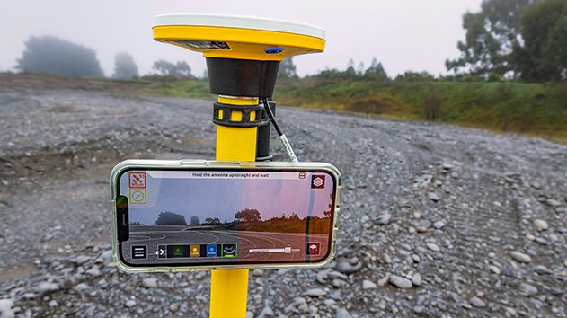
Pair satellite-delivered corrections with the model cached on the device before you fly in, and you have centimetre positioning against known as-built geometry in a place with no functioning infrastructure at all.
The hardware exists. The corrections exist. The models exist.
Let me be clear about what I'm not saying.
I'm not suggesting this replaces anything. Search and rescue teams have technical search capability that has nothing to do with us; ground-penetrating and UWB rescue radar, acoustic and seismic life detectors, search cameras, dogs, and a whole INSARAG framework for triaging a collapsed structure. Those tools answer the question is someone alive in there. They are far better at it than any model.
The question I'm asking is the one before that. Where do we start digging?
And that's a spatial data problem, which is the only kind of problem I'm actually qualified to think about.
The gap isn't capability. The gap is handover. We build enormously detailed digital records of infrastructure: alignments, levels, structures, services, and then we archive them. The model's job is understood to end at practical completion. Nobody hands the as-built to the people who might one day need to find their way back into the thing we built, in the dark, against a clock.
So that's my hypothesis for today. Can you combine construction data with rescue efforts in situations where things have gone wrong? Can you repurpose the hardware and the software for an environment where you are, for once, not designing and building something, but where the information about what you did build might save a life inside the narrow window where rescue is still possible?
I don't know. I'd like to find out, and I'd like to be wrong in useful ways rather than quietly right in a blog post.
Thunderbirds had a vehicle for every disaster. We might not need one. We might just need to stop treating the model as something that dies on handover.
Somebody looked at a tank, a fighter jet and a fire hose and saw one machine. What can we look at when we see SketchUp?
#RealityCapture #SketchUp #GaussianSplatting #DisasterResponse #DigitalTwins #Trimble
References: